A fascinating Iron Age broch and village and spectacular coastal hikes on Orkney.
Orkney pages:
Orkney
Neolithic Orkney
Broch of Gurness, Yesnaby Cliffs, Marwick Head
Rousay & Hoy
The fabulous remains of Neolithic Orkney are justifiably famous. In strong contrast the Orcadians of the Bronze Age, around 2500-800BC, have left little that has yet been discovered. The best are evidence of cremations and burials, barrows in the landscape such as at the Ring of Brodgar, and many burnt mounds, the origins of which are rather mysterious.
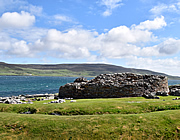
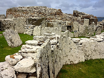
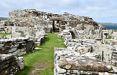
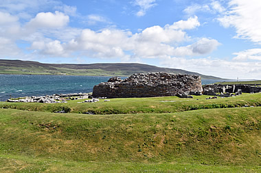
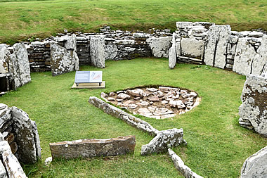
The Iron Age, around 800BC to 500AD, is quite different, exemplified by the remains of brochs, archetypal stone towers which belong securely to this era. The brochs are truly impressive and the Broch of Gurness is probably the best preserved, with the remains of an Iron Age village huddled against its walls.
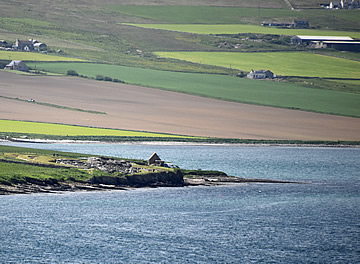
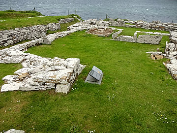
It stands on a northern promontory of the mainland, projecting out into Eynhallow Sound, between Orkney mainland and the island of Rousay. It thus has excellent views out over the water in all directions, affording very good advance warning of anyone approaching. There are at least 10 on both shores of Eynhallow Sound.1
At this time waterways were the highways of the islands and most brochs are situated overlooking the sea. This also, of course, provides easy access for their own movements and fishing.
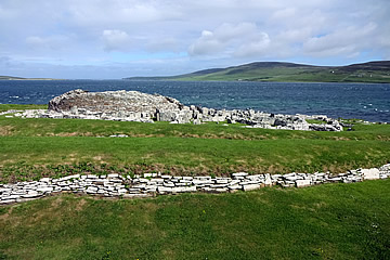
The broch was surrounded by three ditches and banked earth ramparts.
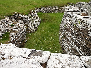
The ditch and rampart arrangement supports the idea that this was a defensive settlement, the broch itself used as a lookout for enemy raids and, at a pinch, could shelter the inhabitants of the domestic buildings clustered around it.
Our guide said that raids were often mounted by rivals to secure slaves to barter with the Romans.
The area within the ramparts is over 40m in diameter with a causeway on the east side leading directly to the broch entrance.2
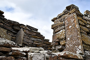
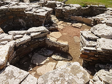
The brochs were all double-walled, with a staircase in between the walls. We thought immediately of the Nuraghe of Sardinia, which are also double-walled, but our guide said this was probably just a coincidence.
Often the double-walled structure would later be stabilised by filling the cavity with rubble and other material, and a new staircase would be built on top. Gurness has three such staircases.
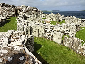
The remaining tower walls stand to a height of 3.6m, the interior around 10m in diameter and the surrounding wall upto 4.4m thick. Originally it could have been over 12m high when it was built, possibly in the 1st century BC.
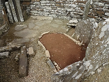
Inside the broch has a central hearth, shelving set within the walls, a well, and an opening in the floor with a shaft and steep stairs leading down to an underground domed chamber which may have had a spiritual use - near the bottom of the shaft a tank in the floor probably once held fresh water; some items thought to be offerings were found here.
A variety of structures surround the broch with many interesting features alongside the usual hearths and wall shelves.
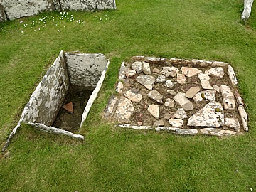
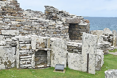
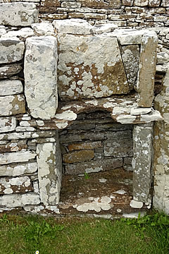
Several features which may have been toilets have been discovered. They are narrow alcoves with a flat slab set off the ground with a circular hole in it. A pot below could have caught waste to be disposed of outside the village. There is also evidence of a drainage system.
Alternatively it could have been used for cooking, perhaps a round-bottomed pot sitting on the hole and heated from below? This is a very common cooking method all over the ancient world.
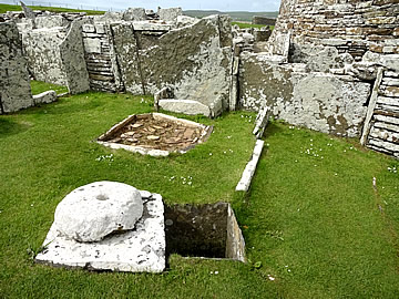
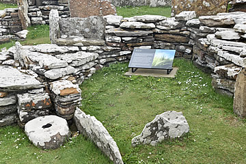

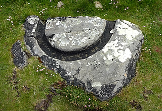
The surrounding fields were fertile and would have been used for grain crops. This would have been processed to prepare bread, porridge or even beer, or stored for use over winter. Several quern stones were found in the village, used to grind grain. Though barley was the staple crop, wheat, peas and beans may also have been grown.
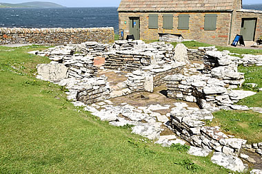
Though the village was constructed in the Iron Age, it was occupied to a greater or lesser degree right through the Pictish and Viking eras.
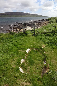
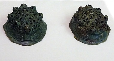
There is a Viking graveyard to one side near the coast, with the grave of a Viking woman. It's a boat-shaped grave in a position which is almost a slipway into the sea - very symbolic for such a sea-faring people. Along with an iron sickle and an iron necklet she was buried with two "tortoise" clasps which can be seen in Kirkwall museum.
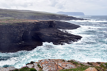
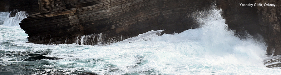
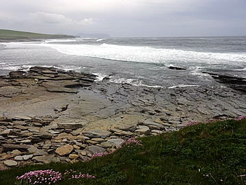
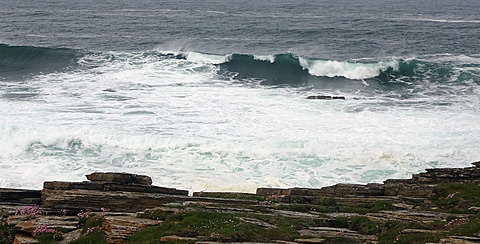
South of Skara Brae these spectacular cliffs make for a good, easy walk. There's a car park right next to a wartime battery on the cliffs.
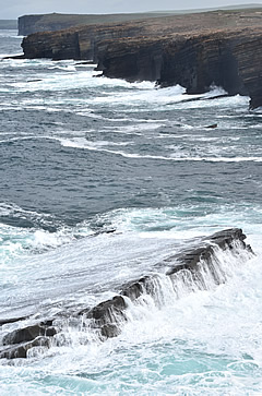
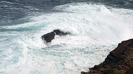
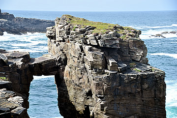
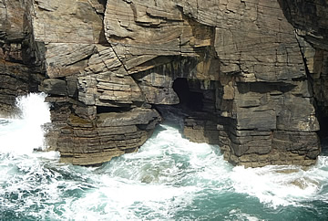
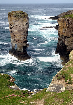
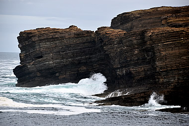
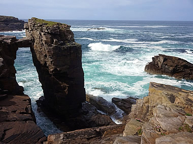
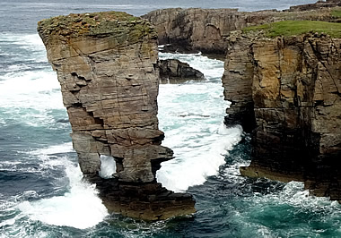
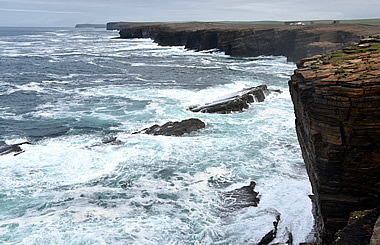
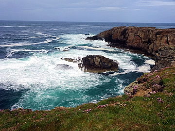
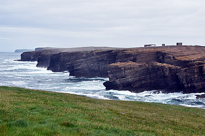
Not at all strenuous and with fabulous views up and down the coast.
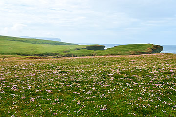
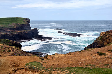
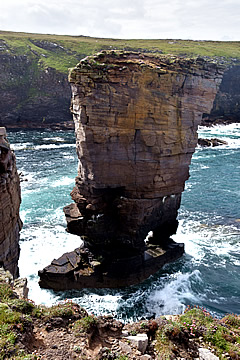
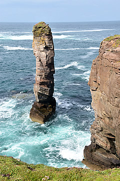
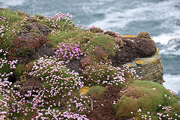
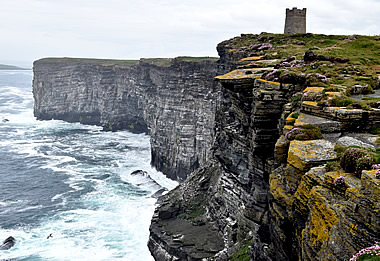
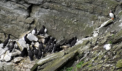
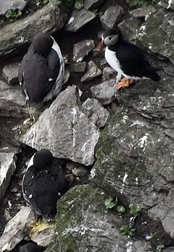
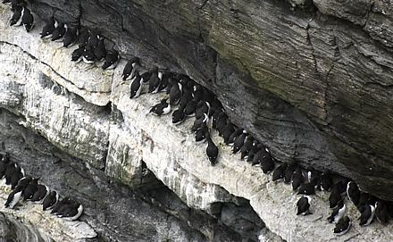
Marwick Head is a little further north of Yesnaby along the west coast of the mainland. Again there is good car parking but here it is close to the shore so there is a steepish climb to get up onto the cliffs, but well worth it.
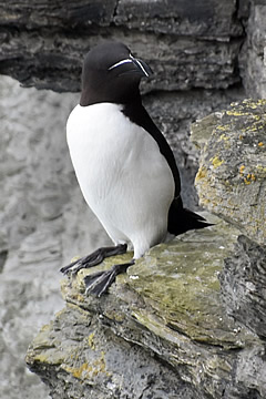
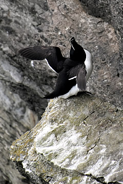
Andrew wanted to see the Kitchener Monument, I was more interested in seeing if I could spot my first puffin!
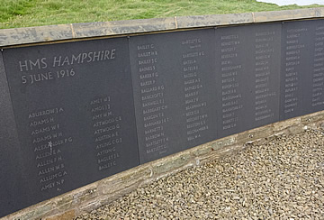
On the 5th June 1916 HMS Hampshire was sailing north two miles off Marwick Head when she struck a German mine and sank with the loss of 737 lives, including Earl Kitchener, Britain's Secretary of State for War. There were only twelve survivors.
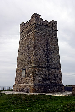
The Kitchener Memorial was unveiled in 1926 and a commemorative wall inscribed with the names of all those who died was built in 2016.
References