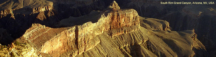
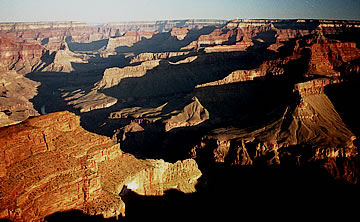
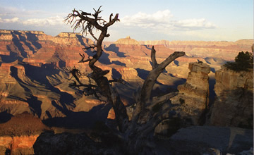
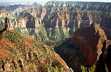
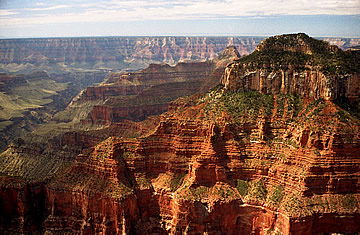
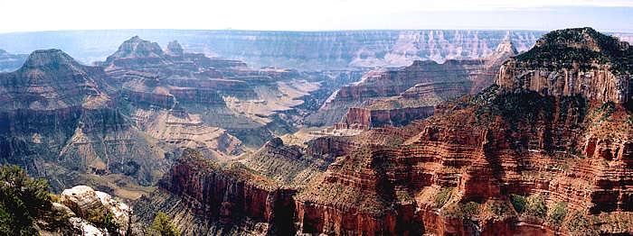
Deservedly one of the natural wonders of the world. We have visited the south rim, north rim, west rim floor of the canyon and Toroweap. Each has awesome landscape but Toroweap is hands-down the best spot to appreciate the scale of this magnificient canyon.
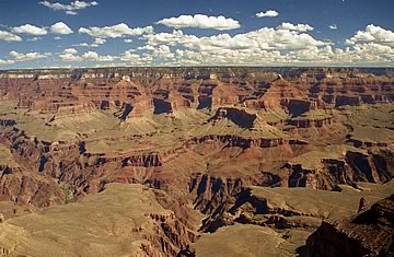
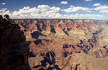
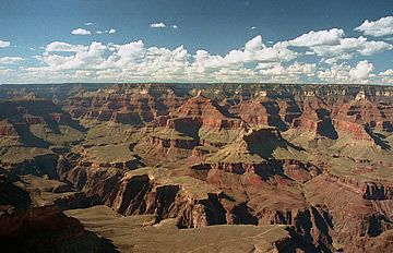
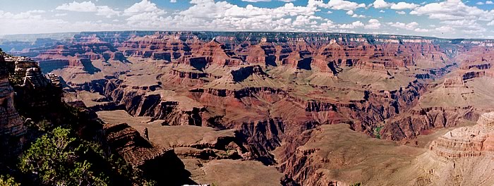
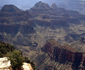
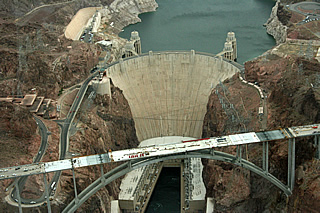
2005 On our first visit we flew to Las Vegas staying there before driving out early one day to cross the Hoover Dam before heading north on Route 66 (had to drive on this!) and swapping drivers at Peach Springs, making sure we had plenty of water with us. The car was air-conditioned - a necessity in these temperatures. North to the south rim of the Grand Canyon where we bought a National Parks Pass for $50 which covered us for most of the parks we wanted to visit in 2005. Then to the canyon at Mather Point - a superb view at a good time of day, around 3.30pm. We walked along the rim to Yavapai Point, marvelling at the glorious scenery. The scale of the canyon is hard to grasp: it's about a mile deep down to the river but varies in width along the length of the Colorado. At the south rim it is 10 miles wide. Though this means that the depth is disguised somewhat, the landscape is never less than awe-inspiring.
As this was a trip arranged not long before departure we were unable to stay in the Park, but had a room just outside. This is not a problem really. I have stayed on the rim previously and it just means that you have to get up a little earlier to see the dawn if you're outside - the park is easily accessible for both dawn and sunset visits.
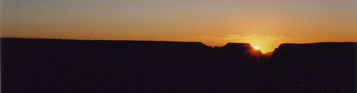
The following morning we were at Bright Angel Lodge parking at 5.20a.m. and walked the south rim trail to Maricopa Point for sunrise. No-one else was around and it was wonderfully peaceful and atmospheric.
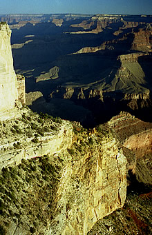
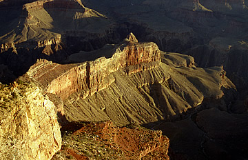
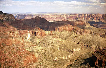
We walked along the south rim via Hopi Point and Mohave Point, taking photographs all the way, and on to the Abyss. Impossible to describe how breath-taking this landscape is - and it's also hard to capture in a photograph, but we did our best.
We caught the shuttle bus and stopped off at Pima Point where we could hear the mile-long rapids on the Colorado in the canyon seven miles away.
Took the shuttle bus again via Hermit's Rest to El Tovar for an excellent breakfast - steak and eggs! This is the place to stay if you're organised!
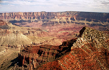
After breakfast we drove 25 miles of the Desert Rim, stopping at Pipe Creek Vista, Shoshone Point (a great view east - all the others are north), Lipan and Desert View, with its mock "Watch Tower". On the way back we stopped at Moran Point, so we feel we're doing it justice!
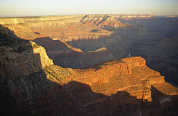
Later we took the shuttle to Yaki Point for the sunset but, although nice, and great light for photography, it is not as dramatic as sunrise.
The following morning was another early start for the shuttle to Hopi Point for sunrise. Again impressive but lots of people here and we preferred yesterday's solitude.
Couldn't resist breakfast at El Tovar again, then headed out via Desert View Drive, stopping for the excellent view at Navaho Point before heading for the open road.
Next time we come we'll some way get down to the valley floor - not sure I trust those mules though!
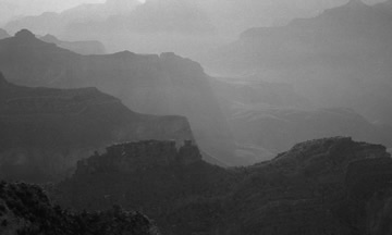
The Grand Canyon at the south rim is one of the most impressive natural spectacles in the world. It's so vast it's almost impossible to appreciate the immensity of it, especially in flat, mid-day light. The best impression is at dawn when the shadows lengthen and the contrast in light and shade better reveals the depth and scale of the landscape.
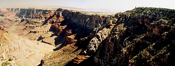
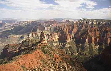
On the return part of our circular journey in 2005 we stayed in Kanab so that we could make a visit to the North Rim of the Grand Canyon. Highly recommend Houston's Trails End Restaurant for superb breakfast. We later had excellent steaks at Rocky V but the experience somewhat diminished by the waitress adding 20% to the bill "to make it easier for you"!
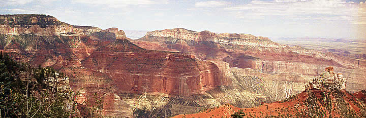
Again, stupendous views, though there are only a few places with access to the rim. Somehow it seems easier to take in the grandeur and scale than on the South Rim, though we're much further east than we were there. Point Imperial and Bright Angel Point particularly impressive. We had a picnic lunch and a Mule Deer came to see if there was any chance of food (none) - a beautiful, delicate creature.
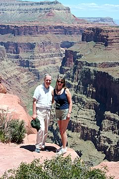
2010 We wanted to go down onto the floor of the canyon and decided to take a helicopter in over the west rim. We went with Maverick Tours and were very satisfied with their service - lucky enough to have the front row seats on the flight in!
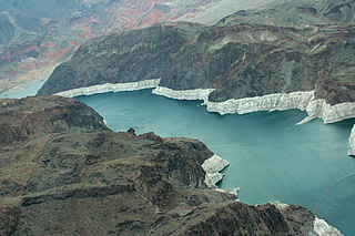
The flight goes over the Hoover Dam for a great view - the new road bridge was under construction while we were there, it's now completed (2011) so no more driving over the dam itself which was a great thing to do. The western canyon is easily accessible from Las Vegas and the flight in is fantastic.
On the two videos you hear the noise of the helicopter but the passengers all have headphones on with background music - I think all the operators play the Ride of the Valkyries as you fly over the rim!
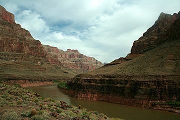
The scenery gets more and more dramatic until the high point (!) of the flight into the canyon - we flew for quite some way along the length of the canyon before descending 3500 feet to land on a flat piece of land some 300 feet above the river.
On the way you pass the Hualapai Nation Skywalk which extends over the canyon 4000 feet above the canyon floor; visitors can look down through the glass floor though this isn't something which appeals to us. You can see it in the video below.
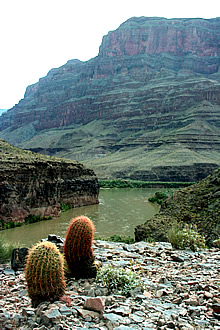
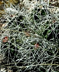
We had half an hour to take in the views (and a light snack and champagne) before returning via Black Canyon to Las Vegas. There are lots of barrel cactii on the river bank - surprisinngly colourful spines.
Highly recommended, especially for the moment when you fly over the rim.
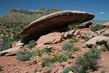
2010 We went with Pink Jeep to Toroweap from Las Vegas, picked up at our hotel and the only passengers that day so very lucky! Our guide, Randy, was fantastic. Very knowledgeable about the history and landscape, a reptile expert particularly keen on snakes - he carries a snake stick with him!
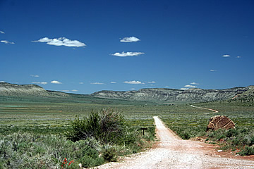
They provided a light snack breakfast of orange juice and philly bagel eaten as we head back up I15 (we'd come down this highway the evening before). Its 5 hours to Toroweap, of which at least two are on dirt road and very rough track. The pink jeep is a hefty, sturdy vehicle, four wheel drive (absolute necessity) and with very heavy-duty tyres.
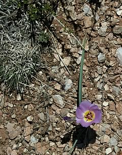
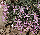
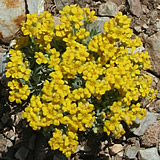
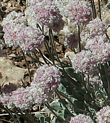
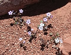
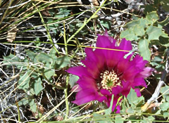
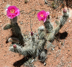
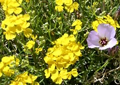
I mentioned that I was interested in the desert plants so Randy stopped along the way whenever he spotted anything interesting. He found one really excellent patch with an amazing variety of plants. Many reminded me of alpine flowers in Switzerland.
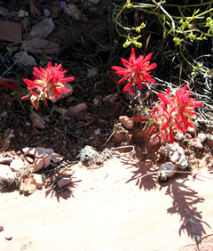
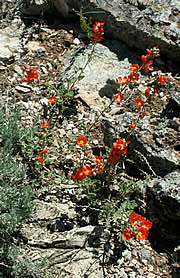
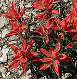
The Indian Paintbrush is everywhere and particularly beautiful.
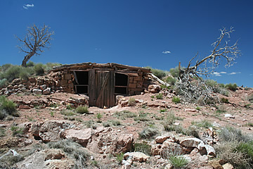
We also stopped at some ancient branding sheds, now falling into ruin. These were used by cattlemen once a year when they came out to brand the new calves.
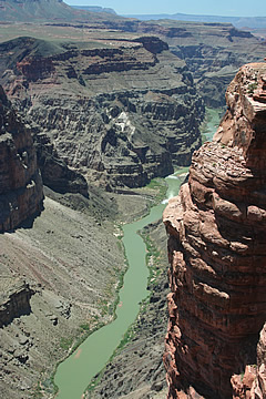
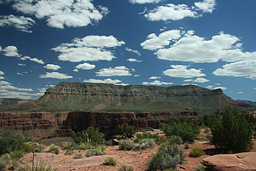
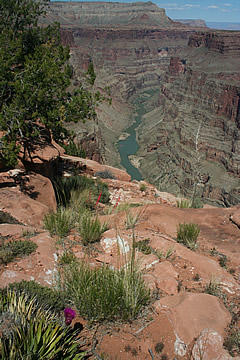
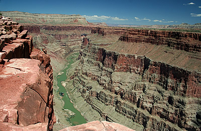
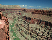
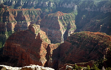
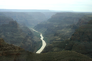
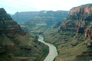
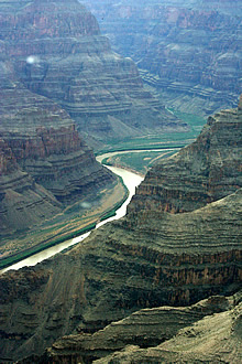
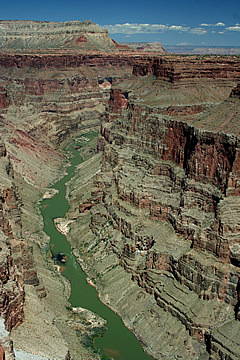
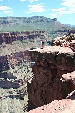
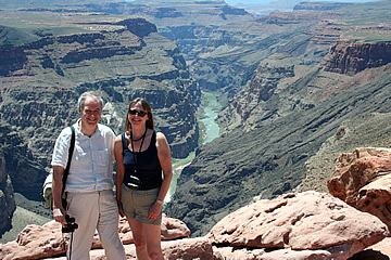
Toroweap is unbelievably impressive. From the rim it is a straight drop down to the canyon floor and the river. These are absolutely the best views of the canyon we have seen. Here it is still 3000 feet deep but with vertical sheer walls and extremely narrow compared to the South Rim (or any other points we've been to) so you really get a feel for the huge scale of the canyon.
We explored along the cliff edge towards the west, jumping some minor gaps. Visibility was fantastic and we could see for miles and miles. We could also hear the rapids downriver and saw a couple of rafts go down.
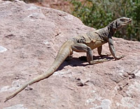
We spotted a huge lizard which Randy identified as a Chuckwalla - certainly the biggest lizard I've ever seen!
Pink Jeep provided an excellent packed lunch of turkey roll, chips, fruit, cookies and water which we had sitting at the rim of the canyon in perfect solitude. For about half an hour we could have been the last people on earth in one of its most impressive spots.
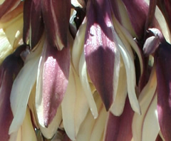
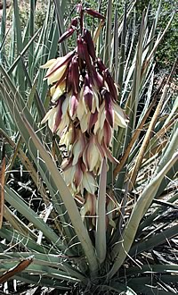
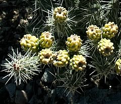
It was a very hot day so we stayed in the shade as much as possible but explored east along the canyon rim after lunch. There are lots of different plants on the rim, some very colourful, including a magnificent yucca with huge spikes of maroon and cream flowers.
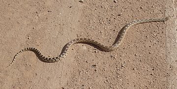
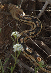
After three hours we began the return journey. On the way Randy spotted a gopher snake on the road. He got out to make sure it was OK and get it into the bush. Catching it with the stick he let us hold it before releasing it - a beautiful creature, it felt dry and muscular. They are a constrictor, feeding on small rodents.
A highly recommended trip, do it if you get the chance.